Integrating climate data in DHIS2 to optimize seasonal malaria chemoprevention in Togo
By analyzing precipitation and temperature alongside malaria incidence data, Togo’s health authorities can plan more targeted campaigns that help reduce infection and death in children under 5.
Climate and weather patterns influence the transmission of malaria and other vector-borne diseases. In West Africa, which includes a range of ecosystems from tropical rainforest and humid savannas of the south to the dry Saharan desert to the north, an intense rainy season of about 3-4 months drives an annual surge in malaria cases – and deaths particularly among children under five years old. Malaria transmission in these areas typically peaks about 1-2 months after the onset of the rainy season because rainfall creates ideal breeding conditions for the mosquitos that transmit the disease to humans.
The WHO recommends seasonal malaria chemoprevention (SMC) as an effective malaria control strategy in places where malaria is highly seasonal and transmission is intense – such as in many districts across the West African country of Togo. SMC campaigns distribute prophylactic anti-malaria treatment (sulfadoxine-pyrimethamine + amodiaquine) to vulnerable populations (primarily children under 5) typically once per month for the length of the high malaria season, to prevent transmission. While SMC campaigns are generally considered a cost-effective intervention, malaria programs need robust climate and epidemiological data to plan for the procurement and distribution of preventative treatment–particularly where, when, and for how long the campaigns should be carried out.
In Togo, the national malaria control program (NMCP) already uses climate data like temperature and rainfall with malaria incidence and other data sources for malaria stratification, an exercise which classifies districts based on malaria risk and helps to plan, budget and implement interventions accordingly. Outputs from this manual exercise have previously been used to justify increased funding to expand the length and geographical scope of SMC campaigns in Togo to adequately cover at-risk areas. Now, thanks to the support of HISP West & Central Africa (WCA) through the DHIS2 Climate & Health project, the malaria stratification dashboard has been added to the NMCP’s DHIS2 system, using the DHIS2 Climate App to pull in weather data in near real time, providing greater access to the data at the district level and aiding the operational planning of SMC campaigns.
Using climate and health data to plan SMC campaigns
Malaria-endemic countries typically conduct a malaria stratification exercise every 3-5 years to classify geographical areas according to malaria risk; and help programmes to plan and target interventions where they are most effective. However, changing climate factors often require programme planners to assess eligibility for specific interventions like SMC more frequently. Because precipitation is a key factor in planning SMC campaigns to coincide with the beginning of the heaviest malaria transmission season, integration of climate data with health data is critical.
For countries like Togo, programmes need data to answer the following questions:
- Where (which districts) are eligible for SMC campaign activities? Where will this intervention have the most impact based on climate, at-risk population and other factors?
- What is the optimal time for each eligible district to begin SMC campaigns, given that this seasonal intervention should begin just before the high-malaria season in order to optimize coverage?
- How many cycles of SMC does each district need to ensure children are protected throughout the duration of the high-malaria season?
- How many children do we need to reach and how many antimalarials need to be procured and shipped to relevant health facilities?
In 2024, the Togolese NMCP worked with WHO and a team from Northwestern University to develop detailed analyses of rainfall and malaria case data to plan annual SMC campaigns. Malaria case data and other program data that are already routinely captured in the national DHIS2 system were extracted and compared against a district-level rainfall indicator that identifies when districts should start the campaigns based on consecutive peaks in rainfall. This work was done using legacy DHIS2 data spanning from January 2015 to December 2021.
This analysis revealed a need to expand the geographic and temporal coverage of SMC campaigns to additional districts based on changing climate factors. In three northern regions, it was determined that extending SMC from four to five monthly cycles would have the greatest health impact given the length of the rainy season in those regions. Togo’s MoH successfully used this analysis to advocate for additional commodities and updating budget allocations in country grants from The Global Fund and other NMCP funding partners, which will support the expansion of SMC campaign activities into newly eligible districts starting in 2025.
At the time the district level rainfall indicator analysis was carried out for 2024 planning, climate data such as rainfall was not yet available in DHIS2, requiring substantial manual work to conduct the analysis and limiting the potential for making these data visualizations available in a dynamic way for district-level users.
Dynamic sub-national planning using DHIS2 Climate & Health tools
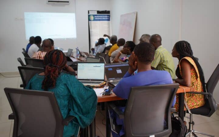
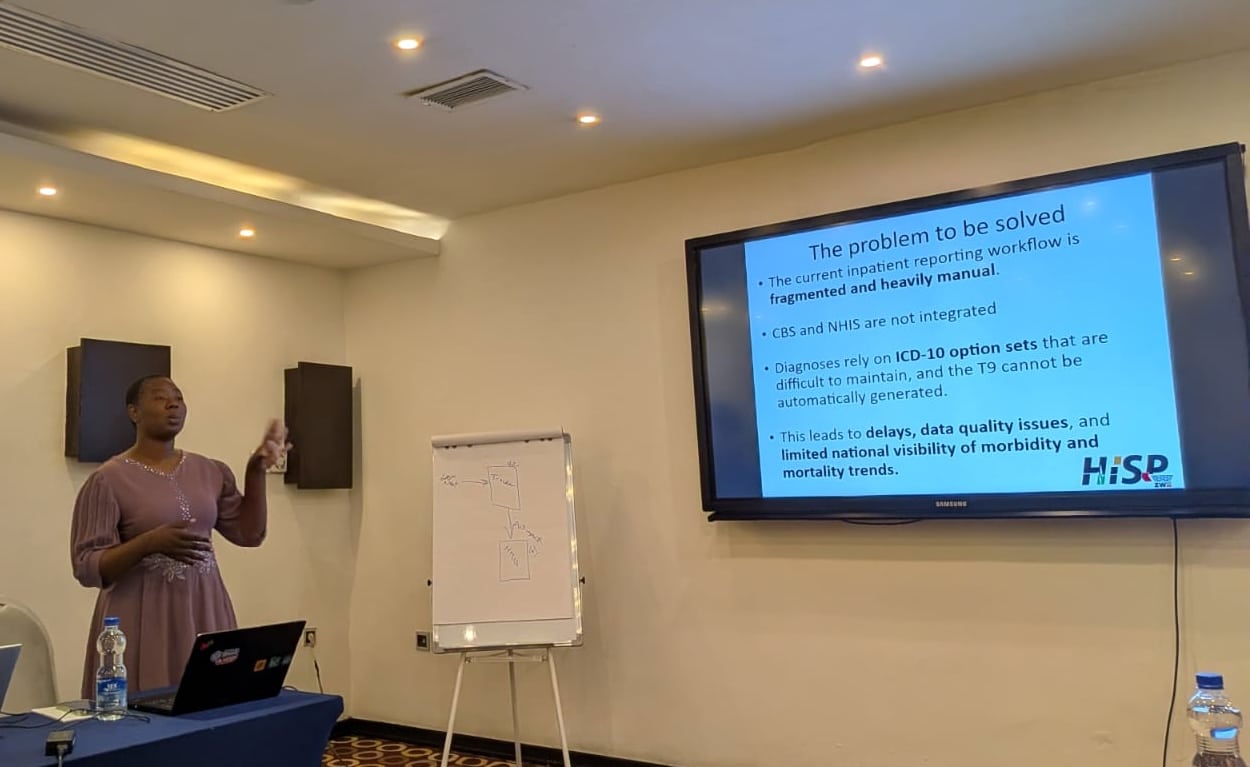
Togo is one of 10 pilot countries in the HISP network’s DHIS2 Climate & Health project that kicked off in 2024. MoH stakeholders identified malaria as a priority focus area to explore how adding climate and weather data to DHIS2 could support more effective analysis and decision making. HISP WCA has provided technical support to the MoH in installing and testing the new DHIS2 tools, including the DHIS2 Climate App and the Chap Modeling Platform. The co-creation of a dynamic malaria stratification dashboard in DHIS2 with the national malarial control programme and the HMIS team is an innovation that is inspiring adaptation in other countries across the region who are also optimizing and targeting their SMC interventions based on climate factors.
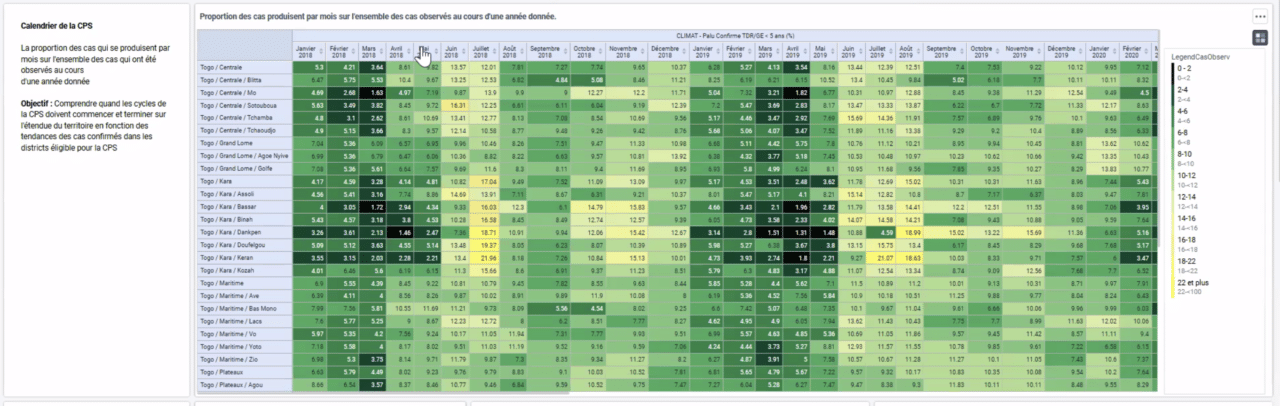
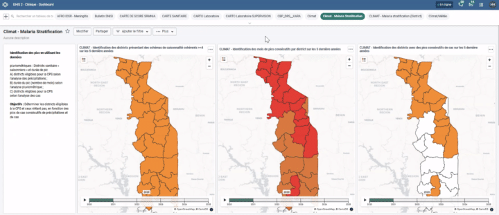
The dashboard includes visualizations that help decision makers quickly analyze the geographic and temporal distribution of malaria peaks in Togo, based on a combination of historical data on malaria cases, captured routinely in DHIS2, and weather data from the ERA-5 dataset that has been imported using the DHIS2 Climate App. A set of two maps using precipitation data show which districts are eligible for SMC campaigns and how many cycles are needed, while another map validates this eligibility using data on peaks in malaria cases. A detailed table breaks down the seasonality per district, showing in which months have the highest incidence of malaria, facilitating more targeted campaign planning.
Building this dashboard in DHIS2 is helping Togo make this data more operational. Previously, this malaria stratification analysis was done outside of DHIS2 on a biannual basis, and was typically only accessible to NMCP stakeholders at the national level. Now, with the DHIS2 Climate App available to provide regularly updated weather data, the NMCP can provide these types of analyses in DHIS2 in “near real-time,” with information tailored to sub-national levels. This helps to improve the use of the analysis at district level and help with operational planning of the SMC campaigns.

Real-time insights help prioritize resources in uncertain times
Like many low- and middle-income countries around the world, Togo was hit by the sudden cuts in development funding from U.S. sources in early 2025. Initially, it appeared that these cuts would affect the NMCP’s ability to carry out the expanded SMC campaigns that were planned for later in the year. In this period of uncertainty, program stakeholders were able to use the malaria stratification dashboard in DHIS2, alongside other sources, to evaluate fallback options for how they could carry out the most effective SMC campaign possible with reduced financial resources.
Fortunately, Togo’s funding to carry out their original SMC campaign plan was ultimately secured, at least for 2025. Now, the NMCP is discussing how this data-driven approach to resource mobilization and allocation can be leveraged for other malaria interventions, such as planning the next national bednet distribution campaign in 2026, which should be optimally timed to just before the onset of the high transmission season in each region or district.
Looking ahead, Togo’s MoH, including the NMCP and the HMIS teams, are collaborating with HISP WCA to further enhance the utility of climate data for predictive analytics. The MoH, in collaboration with the National meteorological Agency (ANAMET-Togo) is testing the new DHIS2 Modeling App, which brings the power of machine learning and predictive modeling to existing national DHIS2 systems through the Chap Modeling Platform. This approach will enable Togo’s health sector to use climate data to improve forecasting, risk assessment, and predict where climate-sensitive disease outbreaks may happen to initiate early interventions.
Taken together, the integration of climate and health data with novel modeling approaches in DHIS2 will help Togo to protect the country’s most vulnerable people, reduce the burden of malaria and save lives. This work has been made possible because of the willingness of local stakeholders, from the HMIS and NMCP teams to ANAMET-Togo, to cooperate and innovate. Discussions are now ongoing with other stakeholders in the country to strengthen climate-health data use for improved health service delivery and to further increase the resilience of the health system.