
The DHIS2 Annual Conference takes place from 15-18 June 2026! Learn more

The DHIS2 Annual Conference takes place from 15-18 June 2026! Learn more
DHIS2 provides flexible tools for integrating climate, weather, and environmental data–as well as other geospatial data sets–into DHIS2 data elements to facilitate analysis of climatic impacts on health outcomes and support predictive modeling of climate-sensitive diseases.
In many health programs–such as infectious disease surveillance or maternal and child health–health outcomes can be directly and indirectly influenced by local climate variation, extreme weather events, and changes in human behavior linked to weather factors and climate change. Understanding the relationship between climate, weather, and environmental data and health outcomes is essential for developing effective public health interventions and adaptation strategies. This is especially true as climate change affects weather patterns worldwide.
Ministries of Health in 75+ countries use DHIS2 as their locally owned, national-scale system for health information management, leveraging it for data-driven decision making across health programs. Through the DHIS2 Climate & Health project, we have worked with international experts and local stakeholders in 10 countries in Africa and Asia to develop innovative tools that make it possible for countries to easily integrate climate data drawn from the best available data sets–both local and global–into their existing DHIS2 systems, helping to strengthen their climate-resilience.
The data integrated with these tools can be analyzed and visualized using the built-in analytics features in DHIS2, and can be used to power predictive modeling and forecasting of climate-sensitive diseases through the DHIS2 Chap Modeling Platform.
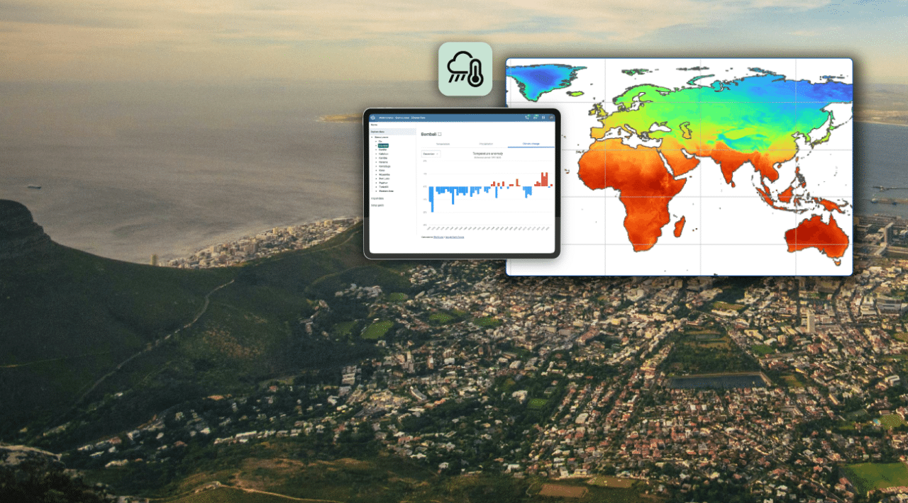
The DHIS2 Climate App is a DHIS2 application that provides a means to easily integrate historical and current weather and environmental data from high-quality global datasets into DHIS2 through a user-friendly interface, with no coding required. It can be downloaded and installed into an existing DHIS2 system through the DHIS2 App Hub.
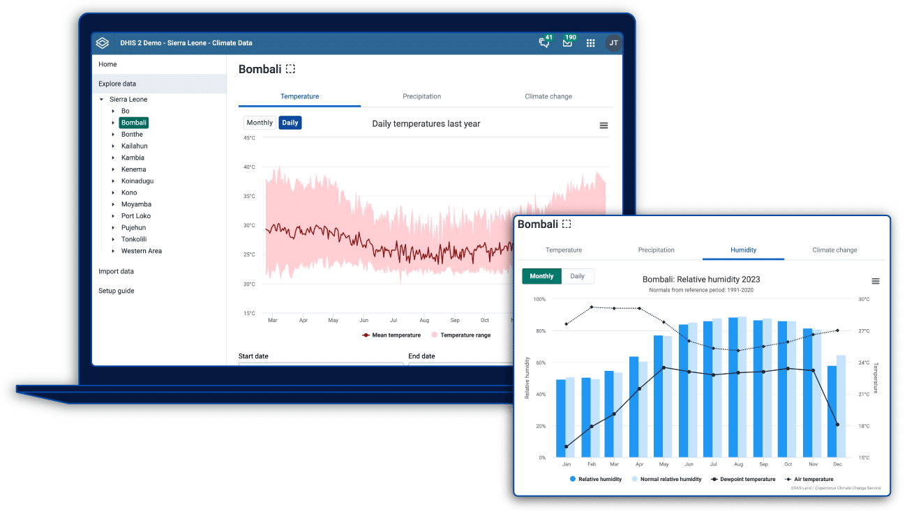
The app allows DHIS2 users to explore daily and monthly temperature, precipitation, and humidity data–and more–for your organization units, and to import it as DHIS2 data elements. These data sets are automatically harmonized with health data in DHIS2, allowing them to be analyzed and visualized together through a variety of charts, graphs, and maps. They can also be used for predictive modeling through the DHIS2 Modeling App and Chap Modeling Platform.
The app draws on a curated selection of high-quality data sources, including ERA-5 land, which is considered to be the most accurate and complete climate dataset available with worldwide coverage, the CHIRPS rainfall dataset, and satellite-based datasets from the Climate Hazards Center. Current datasets available in the Climate App include:
The data is calculated for DHIS2 organisation units by using Google Earth Engine. DHIS2 instances must have the Google Earth Engine enabled in order to use the Climate App. DHIS2 Climate Tools provide a fully open-source alternative, and we are currently working on open-source alternatives for data harmonization within the Climate App itself.
DHIS2 Climate Tools is a toolkit containing open-source libraries and workflows that you can use to access, process and upload local and global climate, weather and environmental data–or other geospatial datasets, such as intervention data–to DHIS2 and the Chap Modeling Platform. This toolkit is available on the DHIS2 Climate Tools website.
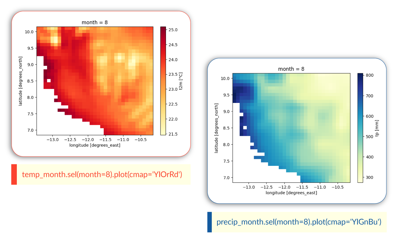
DHIS2 Climate Tools are based on the Python programming language and ecosystem. Python is the leading programming language for geospatial analysis, offering a rich ecosystem of libraries and tools to build on, and helping make complex spatial operations accessible to both beginners and experts.
Unlike the DHIS2 Climate App, using DHIS2 Climate Tools requires programming skills. This toolkit is intended for two primary audiences that carry out different functions related to climate data and DHIS2:
On the DHIS2 Climate Tools website, you can explore existing guides and workflows that have been developed by HISP HiO and our partners in the HISP network. DHIS2 Climate Tools and are fully open source and are intended to be a collaborative toolkit–we welcome input and contributions from the global DHIS2 community.
DHIS2 tools for climate data integration are continuously evolving to respond to emerging country needs and global knowledge on climate and health. We invite you to share your questions, experiences, and ideas for data integration on the DHIS2 Community of Practice.