The DHIS2 Annual Conference takes place from 15-18 June 2026! Learn more

The DHIS2 Annual Conference takes place from 15-18 June 2026! Learn more
Strengthen national health systems with innovative tools for climate and environmental data integration and predictive modeling, enabling data-driven decisions to address a wide range of climate-sensitive health risks and impacts
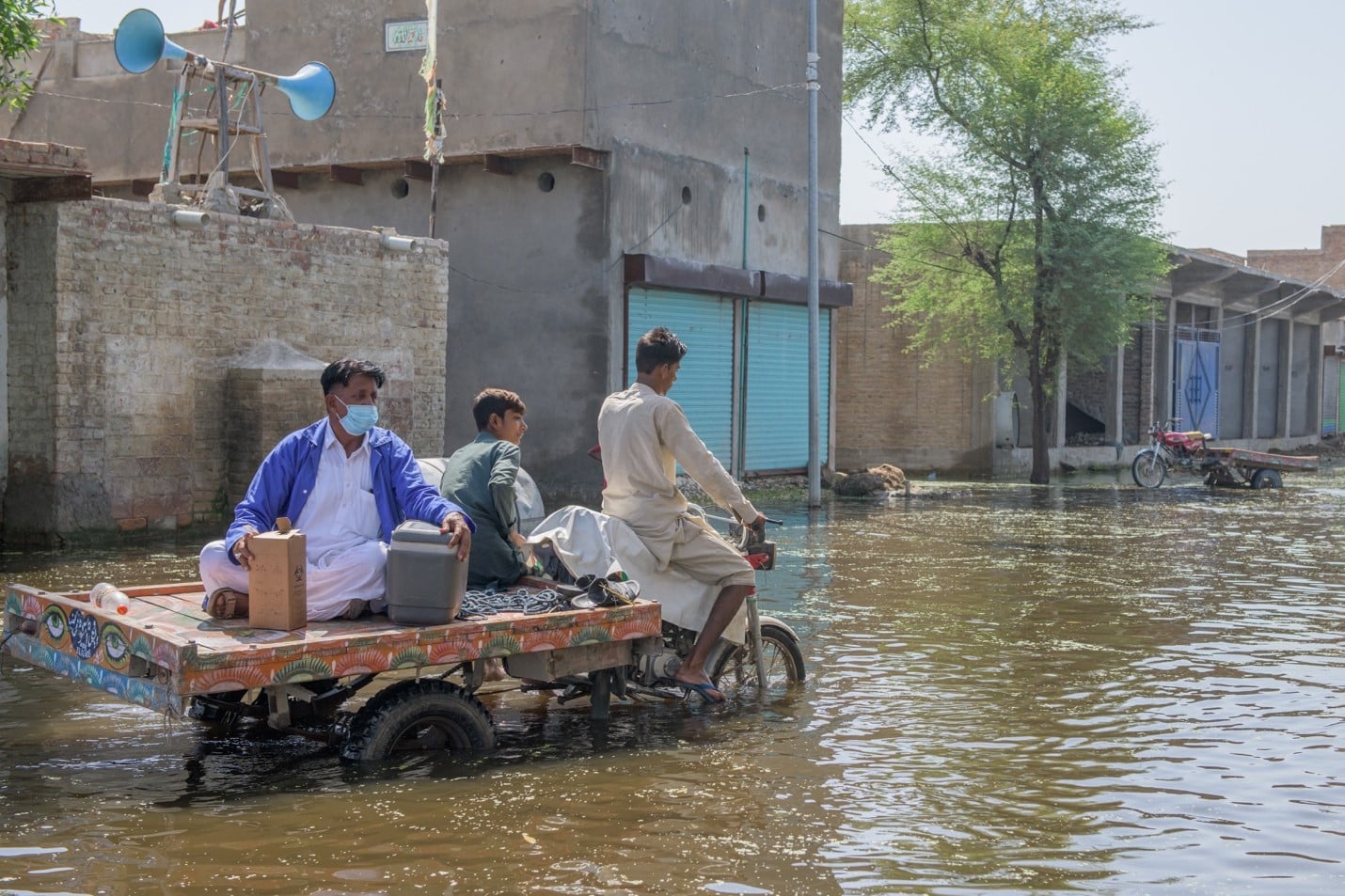
The potential effects of climate change and related ecosystem disruptions are dramatic and wide-ranging, touching every part of life on our planet, including human health. In many health programs – such as infectious disease surveillance, maternal and child health, and nutrition and food security – health outcomes can be directly and indirectly impacted by environmental factors, including local climate variation and extreme weather events like floods and heat waves that are linked to global climate change. Urgent action is needed to protect at-risk communities and prevent negative health effects, particularly among populations most vulnerable to the impacts of climate change and variation on population health. Planning and prioritizing that action requires accurate and actionable data on the specific correlations between climate and environmental factors and health outcomes.
To help strengthen climate resilience, DHIS2 for Climate & Health leverages the widespread adoption of DHIS2 as a Health Management Information System – currently used by 75+ low- and middle-income countries at national scale – and enhances them through the integration of climate, weather, environmental, and earth observation data; the development of flexible and user friendly predictive modeling tools; and the design of climate services and dynamic dashboards to support effective and timely analysis and decision making in response to climate-sensitive health risks.
Since early 2024, 10 countries have partnered with local groups in the HISP network on co-designing and implementing DHIS2 Climate & Health interventions and innovations, helping inform our global work on this initiative and laying the groundwork to bring these tools to routine operational use. In recognition of its potential to support climate-resilient health systems at national scale, DHIS2 has been officially designated a Global Good for Climate and Health.
On this page, you can learn about the innovative DHIS2 tools that support the effective use of climate and health data, explore a selection of programmatic climate-health use cases, read updates and lessons learned from the ongoing action research being conducted by the HISP network, and find resources to help get started with DHIS2 for climate and health. If you would like support with a national or regional climate and health project, contact us at: climate@dhis2.org
Countries can support a wide variety of climate and health use cases depending on local priorities, health risks, and data availability. Below are some examples of how countries and health stakeholders can potentially leverage DHIS2 to strengthen climate resilience.
The use cases below are exploratory, and this list is not exhaustive. We encourage countries and other stakeholders to contact us for help implementing DHIS2 in these areas, or to explore how DHIS2 can support additional climate-health use cases not listed here.
Explore the new DHIS2 tools designed to support Climate & Health systems:
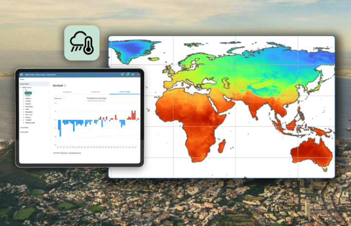
DHIS2 offers solutions for integrating climate, weather, and environmental data—as well as other geospatial data sets—into DHIS2 health information systems to facilitate analysis of climatic impacts on health outcomes and support predictive modeling of climate-sensitive diseases.
These tools include the DHIS2 Climate App, a user-friendly app that leverages Google Earth Engine to allow you to explore and import high-quality global datasets with no coding required, and DHIS2 Climate Tools, a fully open-source, flexible toolkit that supports local data integration and gives you full control over your data pipelines.
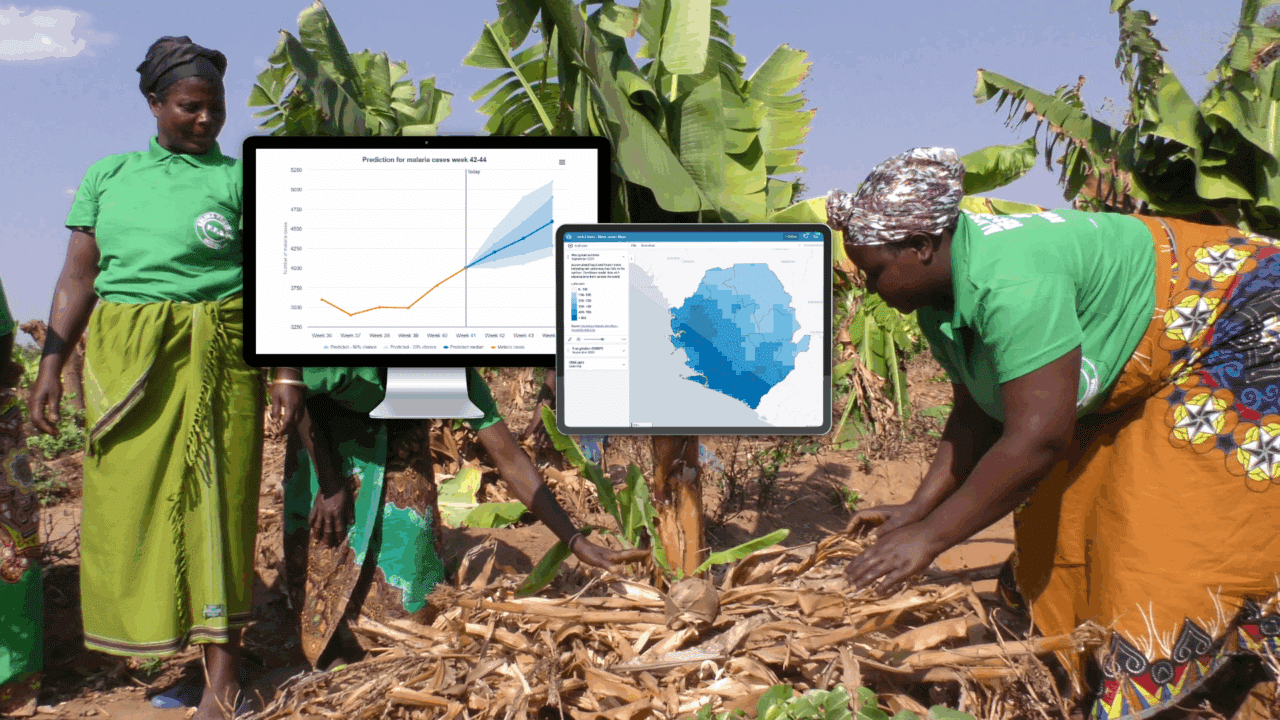
The DHIS2 Chap Modeling Platform is an open-source software platform for climate-sensitive disease forecasting that allows you to develop, access, import, train, tune, run, assess, and share predictive models leveraging the power of machine learning/AI with DHIS2 data. The DHIS2 Modeling App offers a user-friendly Chap interface within DHIS2 for selecting health and climate data to train predictive models, evaluate model accuracy, and generate and visualize predictions.
These solutions are currently undergoing iterative development based with our LMIC partners, and are open for testing by the global DHIS2 community.
Using DHIS2 for Climate & Health allows you to leverage existing locally owned health information systems, incorporating the climate data and predictive modeling features described above into a robust and sustainable platform that is already supported by local infrastructure and capacity, making it easier to operationalize climate and health approaches.
Here are some of the common uses of DHIS2 in the health sector that can serve as the basis for climate-informed health interventions.
National-scale HMIS based on DHIS2 are used in 75+ countries to collect and analyze routine monthly reporting data on health outcomes and service delivery, supporting monitoring, budgeting, and intervention planning across health programs, all the way down to the facility level.
Many countries use DHIS2 as a platform for Integrated Disease Surveillance and Response (IDSR) and Event-Based Surveillance (EBS), providing granular data and infectious diseases and supporting real-time monitoring during outbreaks and other emergencies.
DHIS2 supports collecting and monitoring health data for patients over time. It is used as an electronic registry for health programs such as testing and treatment for both infectious diseases like malaria and non-communicable diseases like hypertension.
When used to collect facility-level stock reporting data, DHIS2 provides visibility into the availability of essential medicines and helps countries monitor stock levels, triangulate with health data, and more effectively distribute and redistribute stock items.
Community health workers act as an extension of the health system to provide critical interventions to the most vulnerable and hardest-to-reach populations. DHIS2 supports collection of community health data and integration with routine health data for comprehensive analysis and planning.
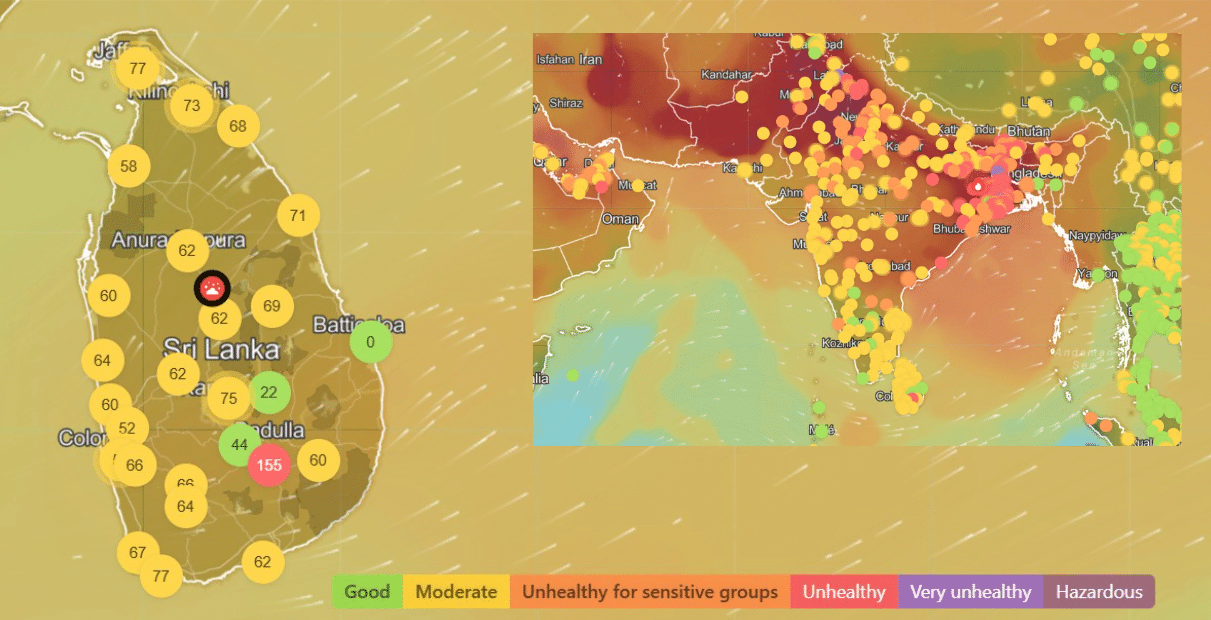
Several countries around the world have begun to explore the potential of incorporating climate, weather, and environmental data into DHIS2 systems. Explore the map below to see recent pilots and ongoing projects.
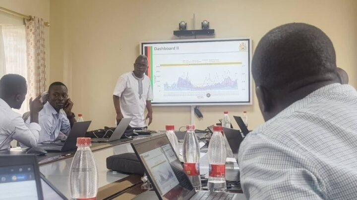
Read the selection of stories below for examples of countries exploring the use of climate, weather, or environmental data in DHIS2 to improve outcomes in health programs and beyond, how the HISP network is collaborating with local partners to develop and test innovative Climate & Health tools, and other news and updates.
Building local capacity is a fundamental element of the HISP approach and key part of the DHIS2 Climate & Health project. We are happy to provide these resources to help share knowledge and develop essential climate and health skills.
This advanced webinar series provides an introduction to time series modeling, statistics and machine learning, climate-health analysis, DHIS2 tools, the Chap Modeling Platform, climate-health data integration, and more.
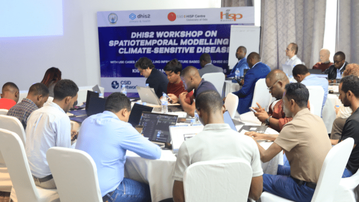
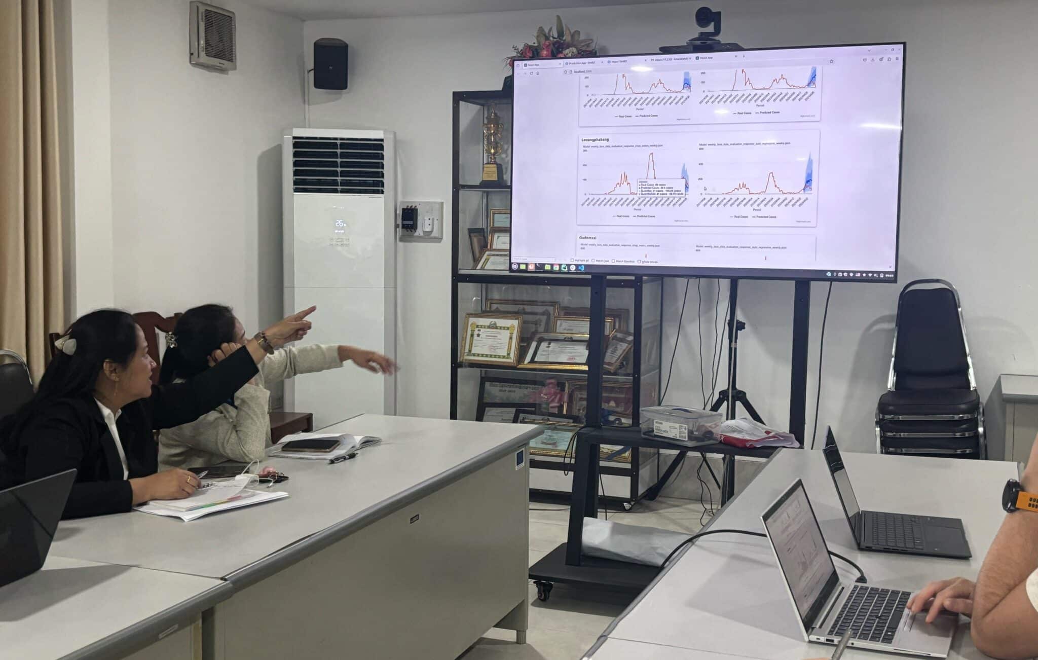
Building on the webinar series, n February 2026, HISP UiO and our partners organized an in-person workshop on spatiotemporal modeling of climate-sensitive diseases in Kigali, Rwanda.
This guide offers users a clear, step-by-step reference on how to install the Climate app and use it within their DHIS2 instance to explore and import climate, weather, and environmental data sets.
On the DHIS2 Chap & Modeling Portal, you can find technical guidance on the Chap Modeling Platform and learn how to develop and share models with DHIS2.
On the DHIS2 Climate Tools website, you can explore existing guides and workflows for integrating local climate, weather, environmental, and other geospatial datasets into DHIS2.
On the DHIS2 documentation website, we provide detailed guidances on how to configure a selection of climate & health use cases in DHIS2.
Explore these resources to learn more about DHIS2 for climate and health:
An overview on DHIS2 for Climate & Health from the 2025 DHIS2 Annual Conference.
Get hands-on experience with DHIS2 climate and health features on our demo site.
Browse a selection of videos and presentations on DHIS2 for Climate & Health.
HISP’s work on DHIS2 for Climate & Health is organized through participatory action research projects, which feature collaborations between HISP UiO, our network of local HISP groups, national Ministries of Health and Meteorological Institutes and other local stakeholders, and an international network of academic institutions, research institutes, and global organizations. These ongoing projects produce research outputs that include the digital tools and shared innovations described on this page, as well as knowledge on how these solutions can be effectively implemented, scaled, and sustained in practice.
In addition to responding to local needs and knowledge, our work is informed global climate and health research, such as these publications:
The DHIS2 Community of Practice (CoP) is an online forum for DHIS2 discussion, support and innovation sharing. Both the use of climate data and predictive modeling in DHIS2 are rapidly developing fields, and the CoP offers a platform for experts from around the world to share innovative approaches, ideas, and needs. You can also use the CoP to ask questions, get support for technical issues, participate in webinars and other informational events, as well as connect with other members of the global DHIS2 implementer community working on climate-related projects.
Join the discussion in these categories:
The DHIS2 for Climate & Health project is led by the HISP Centre at the University of Oslo (HISP UiO), which develops and maintains the DHIS2 software platform and coordinates the global HISP network. This work began in early 2024 with funding from the Wellcome Trust, and builds on long-term investments into DHIS2 as a platform for health information management from our network of global public health partners.
HISP UiO collaborates on this work with local and global partners, including national Ministries of Health, Meteorological Institutes, and other local stakeholders; local HISP groups based in-country; subject matter experts from the Global Health Resilience group at the Barcelona Supercomputing Center, the International Research Institute for Climate and Society (IRI) at the Columbia Climate School, and the CICERO Center for International Climate Research.
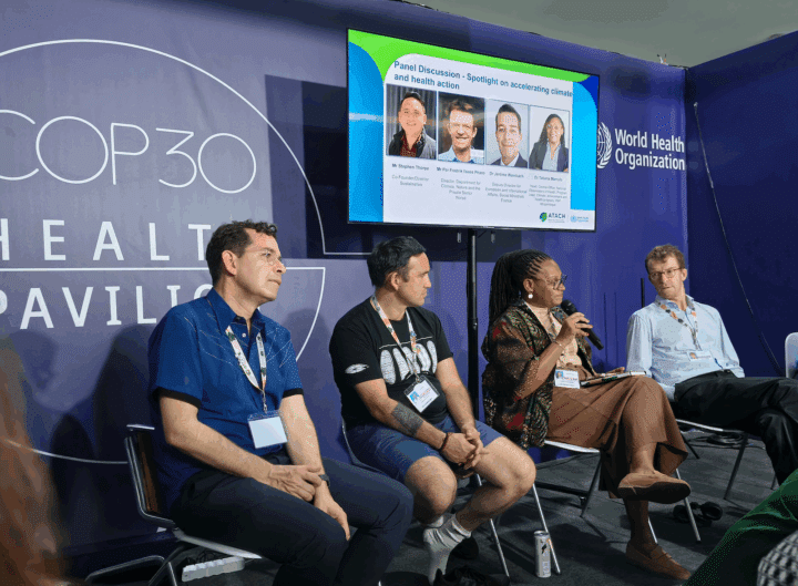
HISP UiO is a member of the Alliance for Transformative Action on Climate and Health (ATACH) and engages with the WHO Climate Change and Health Unit and the WHO/WMO Joint Office to ensure that our work is informed by and contributes to the global body of knowledge on climate and health.