DHIS2 Climate & Health work in Mozambique leverages existing DHIS2 infrastructure and capacity, while testing innovative DHIS2 tools for climate data integration and predictive modeling.
Health information systems & capacity
DHIS2 was officially adopted by the MoH as a national health management information system (HMIS), locally known as SISMA, in 2015, serving as an integrated data platform for routine data across health programmes. Mozambique has a national malaria repository (iMISS) based on DHIS2 that includes campaign data, supervision data, epidemiological data, and entomological data, and also uses DHIS2 for disease surveillance, mortality reporting, community health, and nutrition programmes, as well as to support health logistics and supply chain management. Saudigitus provides technical assistance and capacity building support for national DHIS2 systems in Mozambique.
An initial effort to deploy climate-informed DHIS2 malaria systems in Mozambique was carried out with support from the Clinton Health Access Initiative (CHAI) and Saudigitus, resulting in the development of a prototype dashboard. This could not be operationalized due to technical barriers by the time project funding ended in 2022. However, the lessons learned from this work were instrumental in informing the development of the Chap Modeling Platform by HISP UiO.
The primary climate-health information product that Saudigitus has developed for Mozambique through their more recent work is a district-level predictive early warning system that integrates climate variables with iMISS/DHIS2 malaria surveillance data and produces a dynamic dashboard with 2–3 month district-level forecasts of malaria cases, spatial risk maps, and climate-malaria trend dashboards for program planning. This dashboard is currently a prototype, and has not yet been integrated into routine facility-level dashboards or operational decision making.
Climate data integration
The DHIS2 Climate App has been installed in Mozambique’s HMIS, enabling integration and use of climate data in DHIS2. As a starting point, 36+ months of CHIRPS precipitation and ERA-5 Land temperature data have been imported and harmonised to all 161 SISMA districts. National-level technical teams in the National Malaria Control Programme (NMCP) are currently the primary users of climate data in DHIS2, which supports climate-malaria relationship monitoring through time-series comparing rainfall, temperature, and humidity vs. case counts and analytical cross-tabulations between forecasts and monthly trends at district level.
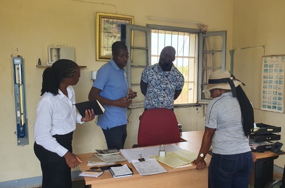
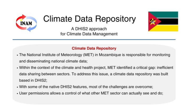
Saudigitus has also collaborated with the National Meteorological Institute (NMI) of Mozambique to investigate potential solutions for digitizing local climate data, including piloting the use of DHIS2 to capture minimal data sets from local weather stations. This work is in an exploratory phase. Mozambique has also begun testing the Open Climate Service platform for data integration.
Predictive modeling
The MNCP’s operational goals for predictive modeling are to be able to generate malaria forecasts with a 2–3 month lead time to guide proactive interventions (IRS, ITN distribution, and resource allocation) to support a shift from detecting outbreaks to anticipating risk.
Saudigitus has installed the Chap Modeling Platform and DHIS2 Modeling App on Mozambique’s DHIS2 production environment and conducted testing sessions jointly with the malaria program that have identified relevant models and data sources. These models have been evaluated in Chap and were found to be appropriate for district-level planning. During testing, Chap alerts identified three potential malaria surges in two provinces with a four-week lead time, which would be sufficient to enable data-driven shifts in IRS intervention timing. However, this system is not yet in operational use due to organizational and technical challenges. SOPs for early warning system alert response are not yet finalized, and there is low capacity for probabilistic output interpretation for the MNCP team. Data quality challenges included some missing data in rural districts and temporal misalignment between climate and health data. In addition, the use of multiple DHIS2 instances across different programmes causes interoperability challenges, and forecast generation has not yet been automated.